
Who owns the strip at the water
Logan Martin is a Coosa River lake run by Alabama Power, whose lake page lists the dam in service since August 10, 1964, and gives the lake 15,263 acres and 275 miles of shoreline (checked Nov 12, 2026). Its shoreline guidelines for Logan Martin and Neely Henry, FERC Project No. 2146, begin with ownership: "Alabama Power owns the pool properties of Lake Neely Henry and Lake Logan Martin," and in some areas holds more rights along the shore.
| Line | Elevation above sea level | What it means |
|---|---|---|
| Full summer pool | 465 feet | The normal summer water level |
| Alabama Power's fee ownership | 465 to as high as 473 feet | Land the company owns outright, above the water |
| Alabama Power's flood easement | 473 to as high as 490 feet | Land where the company holds flood rights |
The guidelines' footnote says the range depends on location and tells owners to call the shoreline office for more. In plain terms: on many lake lots, the strip right along the water belongs to Alabama Power, not to the homeowner, even where the lawn runs straight down to it. Above that, the company may hold a flood easement over part of your yard.
These rules follow the lake, not city lines. They apply the same way to lots inside Pell City or Riverside and to unincorporated shore communities such as Cropwell and Coosa Island, which fall under county rules otherwise. Alabama Power says permits have been required for construction along its 3,500 miles of lake shoreline since 1992.
The 15-foot buffer and the 3-inch rule
Paragraph A-2 of the guidelines sets the buffer. Its stated purpose is "to enhance and protect wildlife habitat and nearshore environments." On Alabama Power's fee-owned land, the permittee must keep a natural vegetative buffer at least 15 feet wide, measured horizontally from the top of full pool, and the company recommends the same on its flood easement land. No construction or related activity may happen in the buffer without the company's prior written authorization.
Activities the guidelines list as not permitted in the buffer:
- "removing any tree measuring more than three inches in diameter"
- clearing any shrubbery more than 4 feet tall
- changing the contour of the land
- laying or seeding sod, grass or a garden
- building any habitable structure, fence or well
- allowing garbage, debris or other foreign material to stay there
One walkway, no wider than 4 feet, may be authorized through the buffer. The paragraph makes no exception for pruning, for views, or for dead or hazard trees. Whether Alabama Power will authorize removing a dangerous tree there case by case isn't stated in the guidelines and couldn't be confirmed for this site. Only the shoreline office can answer that for your lot.
Three inches across is a small tree, so nearly every tree worth asking about is covered.
Written permission, not a nod
Paragraph A-1 requires a written permit from Alabama Power, with a pending permit tag posted where it can be seen, before construction or structure work starts on the company's fee-owned land or flood easement, and it adds that "Verbal approval is not sufficient." The company's shoreline brochure says that "In some instances, vegetation clearing and earth moving may also require a permit."
How it works, from Alabama Power's own pages (checked Nov 12, 2026):
- Its permits page says nearly any work in the lakebed, the flood easement or the control strip could call for a permit, naming only painting and pressure washing as exceptions.
- Applications go through the APCShorelines website, apcshorelines.com/permits, or the company's shoreline app, and the application asks for any subdivision ARC or HOA approvals.
- A 2022 company post says permits can take 30 days or more, depending on the reviews, and that working without a permit "can result in fines."
The guidelines' listed fees are written for structures: $600 for unauthorized construction and $800 for non-compliance, for example, with the permittee liable for Alabama Power's attorneys' fees in enforcement. No tree-specific fine is listed. The cleaner path is to ask first.
A tree leaning out over the water
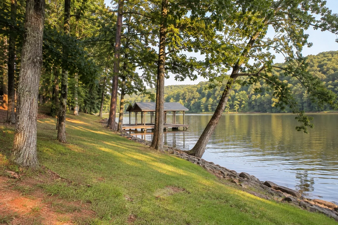
Lake lots often have one: a pine or oak at the shoreline leaning out over the lake, like the one in the photo, sometimes toward a dock or boathouse. No Alabama Power or Extension guidance specific to leaning shoreline trees turned up for this site. What the sources do say:
- Alabama Power wants the natural buffer kept. Its brochure says "the clearing of native trees and vegetation should be kept to a minimum" and that experts suggest keeping "as much existing vegetation as possible."
- The same brochure says the newer approach doesn't mean owners must let vegetation "grow uncontrolled or block their lake view."
- Bank stabilization along the shore is permitted work that needs the company's authorization (Alabama Power, 2019).
- The buffer can't hold debris, so a tree that's cut can't simply be left lying there.
So the right first step for a leaning shoreline tree is a call to the Logan Martin Lake Office, 205-472-0481, with the tree's trunk width, how far it stands from the water, which way it leans, and what it could hit. Photos help. Don't promise a contractor the work until the company has answered in writing.
Storms on the lake
Lake lots get no shelter from wind. Just after midnight on December 28, 2024, a tornado rated EF-0, with 85 mph winds on a path 2.26 miles long and 150 yards wide, crossed the Coosa Island area. The National Weather Service says "Numerous trees were snapped or uprooted, and many fell onto homes near Shady Brook Lane" (preliminary data). Five minutes later a stronger EF-1, at 110 mph, snapped and uprooted hardwoods north of Highway 27 along Roberts Mill Pond Road.
On February 26, 2008, the Pell City–Cropwell tornado, an EF-1 with 105 mph winds and a path 1,100 yards wide, uprooted or snapped "several hundred trees," with 50 to 100 down just north of the Wolf Creek Volunteer Fire Department. And on the morning of April 27, 2011, the straight-line wind swath that killed one person in Pell City ran on along Interstate 20 and through Riverside (all NWS Birmingham, checked Nov 12, 2026).
When a storm drops a tree into the lake or onto a dock, remember that the lakebed is Alabama Power's too. Pulling a trunk out of the water is work in the lakebed, so ask the shoreline office how it wants that handled. The storm guide covers the rest of a storm cleanup.
Winter levels and getting equipment in
Alabama Power lowers Logan Martin each fall. Its fall 2024 schedule had the drawdown starting October 1 and ending November 30, at a normal winter elevation of 462 feet, about 3 feet below summer pool (published September 19, 2024; checked Nov 12, 2026). Whether the fall 2026 schedule matches couldn't be confirmed. Lower water exposes more bank and rock at the shoreline, which changes what a crew can stand on.
When a lake lot slopes down to the water, equipment usually has to come in from the road side. Logs and brush cut near the shore have to be moved back uphill and off the lot, because the buffer can't hold debris and Pell City won't collect a tree crew's limbs at the curb (Ordinance 2017-4778, checked Nov 12, 2026).
Neely Henry and the rest of the county
Neely Henry Lake, also on the Coosa, shares the same guidelines, with a full pool of 508 feet. Ask the shoreline office for the ownership and easement elevations on a Neely Henry lot. Away from the water, Pell City's zoning ordinance contains no Logan Martin or shoreline provisions, and the county's local laws have none either, so on lake lots Alabama Power's rules are the ones that govern trees at the water.
Before you call the shoreline office
- Your address and, if you have it, your lot and subdivision name.
- Each tree's trunk width and kind, if you know it.
- How far each tree stands from the water at summer level.
- What it threatens: the house, a dock, a boathouse, a path, a neighbor.
- Photos from the land and, if you can, from the water.
- Any HOA or architectural review approval your subdivision requires.
Lake lot questions on Logan Martin
My deed runs to the water. Does the buffer still apply?
The buffer is set on Alabama Power's fee-owned land, and the company recommends the same on its flood easement land. Where your property line falls against those elevations is something the shoreline office can tell you.
Can I trim limbs to open up a view?
The guidelines list no exception for views, and they bar clearing shrubs over 4 feet tall in the buffer. The company's brochure also says owners don't have to let vegetation block their lake view. Ask the office what it will allow before anyone cuts.
A dead pine is leaning over my dock. Can it come down?
It may be possible with Alabama Power's written authorization, but the guidelines don't say so, and this site couldn't confirm how the company handles hazard trees. Call 205-472-0481 and describe the risk.
Who applies for the permit, me or the contractor?
The guidelines talk about the permittee, and applications go through the APCShorelines website or app. Agree in writing which of you handles it, and don't let work start before the permit is in hand.
Do Pell City or the county add anything on top?
Not for trees at the water, as far as this site's research found: Pell City's zoning text has no shoreline provisions and the county's local laws have no lake rules (checked Nov 12, 2026). Your HOA may.
This site doesn't apply for shoreline permits or cut trees. A request sent from it reaches one independent contractor who works around Pell City and Logan Martin.
Source notes
- Alabama Power, General Guidelines for Residential Shoreline Permitting & Permit Terms and Conditions, Lakes Neely Henry and Logan Martin, FERC Project No. 2146 (revised July 15, 2025). Checked Nov 12, 2026.
- Alabama Power, Logan Martin lake page, Permits, Contact, Shoreline Management Practices, Permit program supports the lakes we love (June 21, 2019), permitting process post (September 15, 2022) and fall 2024 drawdown schedule. Checked Nov 12, 2026.
- NWS Birmingham, December 28, 2024 tornadoes, Pell City-Cropwell Tornado and Morning Straight Line Wind Damage on April 27, 2011. Checked Nov 12, 2026.
- City of Pell City, Land Use Regulations, 2022 Update and Ordinance No. 2017-4778; Alabama Legislative Services, St. Clair County local laws. Checked Nov 12, 2026.